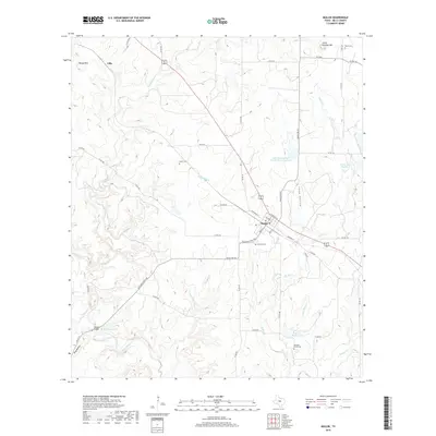
2019 Map of Mullin
USGS Topo · Published 2019About this map
Mullin and the surrounding ranchlands of Mills County are defined by the convergence of several waterways including Mullin Cr, Willoughby Cr, and Pompey Cr which flow toward the Pecan Bayou in the southwest. The town layout is clearly visible along Ranch Rd 573, featuring a grid that includes Sherman St, Masters St, and 3rd St. Evidence of the area's agricultural and rural heritage is found in the scattered family and community burial grounds such as Oakview Cem and Fisher Cem. The landscape transitions from the higher elevations of Round Mtn and Little Pompey Mtn down into drainage areas like Long Hollow. Water management is prominent through features like the Soil Conservation Service Site 1 Reservoir and several named private lakes including Murray Lake and Dennie Shelton Lake.
Find a feature on this map
56 named features on this map. Tap any name to fly to it.
Don’t see what you’re looking for? This feature index may not catch every label — zoom into the map to look around manually.
Map Details
Editions of this 2019 Mullin Map
This is the sole edition of this map. No revisions or reprints were ever made.
Other maps of this area

1885 · San Saba
USGS Topo · 1:125,000

1889 · Brownwood
USGS Topo · 1:125,000

1894 · Brownwood
USGS Topo · 1:125,000

1894 · San Saba
USGS Topo · 1:125,000

1925 · San Saba 2-a
USGS Topo · 1:48,000

1925 · Brownwood 3-d
USGS Topo · 1:48,000

1925 · San Saba 1-b
USGS Topo · 1:48,000

1925 · Brownwood 4-c
USGS Topo · 1:48,000

1928 · Zephyr
USGS Topo · 1:62,500

1928 · Goldthwaite
USGS Topo · 1:62,500