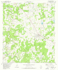
1980 Map of Mullin
USGS Topo · Published 1980About this map
Mullin stands at the center of this Mills County landscape, where the Atchison Topeka and Santa Fe railroad cuts a diagonal line through the rolling terrain. The map captures a transition in local infrastructure, showing the path of the Old Wire Road and the Williams Ranch Road winding through a network of creeks and grazing lands. To the south, the broad course of Pecan Bayou is crossed by the Jackson Bridge, near a USGS Gaging Sta.
Find a feature on this map
32 named features on this map. Tap any name to fly to it.
Don’t see what you’re looking for? This feature index may not catch every label — zoom into the map to look around manually.
Map Details
Editions of this 1980 Mullin Map
This is the sole edition of this map. No revisions or reprints were ever made.
Other maps of this area

1885 · San Saba
USGS Topo · 1:125,000

1889 · Brownwood
USGS Topo · 1:125,000

1894 · Brownwood
USGS Topo · 1:125,000

1894 · San Saba
USGS Topo · 1:125,000

1925 · San Saba 2-a
USGS Topo · 1:48,000

1925 · Brownwood 3-d
USGS Topo · 1:48,000

1925 · San Saba 1-b
USGS Topo · 1:48,000

1925 · Brownwood 4-c
USGS Topo · 1:48,000

1928 · Zephyr
USGS Topo · 1:62,500

1928 · Goldthwaite
USGS Topo · 1:62,500