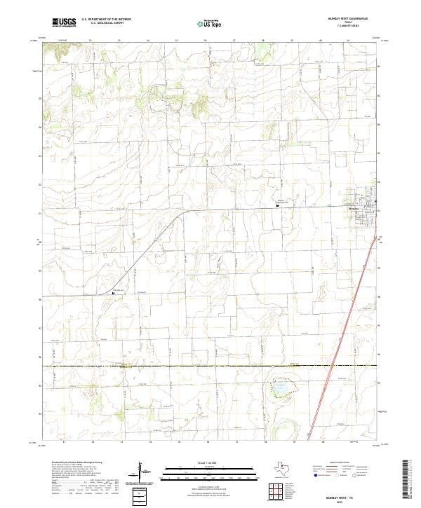
2022 Map of Munday West
USGS Topo · Published 2022About this map
The western outskirts of Munday define the landscape of this contemporary North Texas quadrangle, where the grid-like organization of rural roads reflects the region's agricultural foundations. Farmland dominates the terrain, punctuated by long stretches of farm-to-market roads like FM 1043 and FM 2534. Near the center of the sheet, Johnson Memorial Cem stands as a local landmark, while Gillespie Cem lies further west, providing tangible points of interest for genealogical researchers and those studying the heritage of Knox County.
Find a feature on this map
66 named features on this map. Tap any name to fly to it.
Don’t see what you’re looking for? This feature index may not catch every label — zoom into the map to look around manually.
Map Details
Editions of this 2022 Munday West Map
This is the sole edition of this map. No revisions or reprints were ever made.
Other maps of this area

1954 · Wichita Falls
USGS Topo · 1:250,000

1958 · Wichita Falls
USGS Topo · 1:250,000

1967 · Hefner
USGS Topo · 1:24,000

1967 · Benjamin
USGS Topo · 1:24,000

1967 · Rochester
USGS Topo · 1:24,000

1967 · Weinert
USGS Topo · 1:24,000

1967 · Rhineland
USGS Topo · 1:24,000

1967 · Mattson
USGS Topo · 1:24,000

1968 · Munday West
USGS Topo · 1:24,000
1968 · Munday East
USGS Topo · 1:24,000