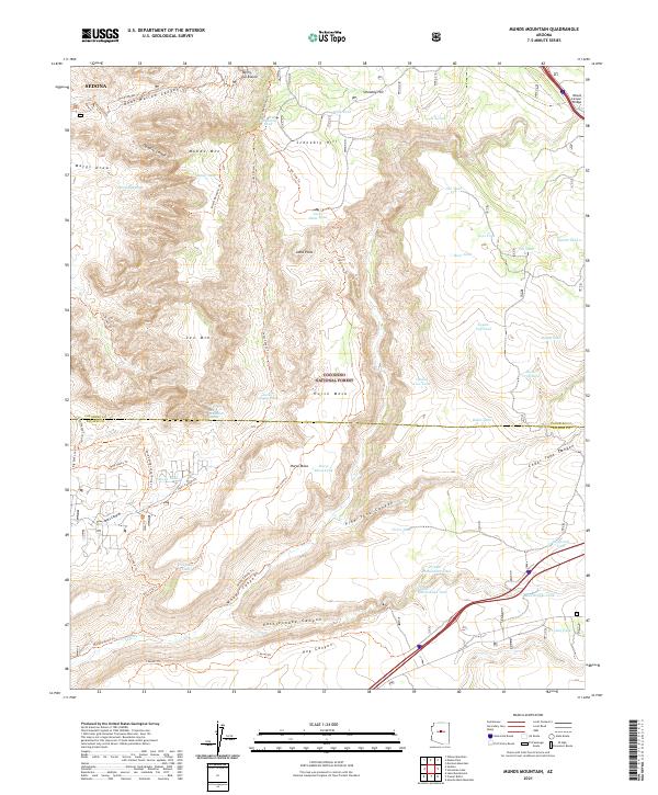
2021 Map of Munds Mountain
USGS Topo · Published 2021About this map
Sedona and its dramatic surrounding geography dominate this modern topographic study, where the high desert plateau breaks into a complex system of canyons and mesas. The landscape is defined by massive formations like Munds Mtn and Lee Mtn, alongside the deeply carved Woods Canyon and Rattlesnake Canyon. A network of historic routes and recreation paths, including the Munds Wagon Trl and the Schnebly Hill Trl, traces the contours of Schnebly Hill and the Coconino National Forest.
Find a feature on this map
63 named features on this map. Tap any name to fly to it.
Don’t see what you’re looking for? This feature index may not catch every label — zoom into the map to look around manually.
Map Details
Editions of this 2021 Munds Mountain Map
This is the sole edition of this map. No revisions or reprints were ever made.
Other maps of this area

1887 · Verde
USGS Topo · 1:250,000

1892 · Verde
USGS Topo · 1:250,000

1923 · Camp Verde
USGS Topo · 1:125,000

1932 · Camp Verde
USGS Topo · 1:125,000

1936 · Camp Verde
USGS Topo · 1:125,000

1954 · Holbrook
USGS Topo · 1:250,000

1957 · Holbrook
USGS Topo · 1:250,000

1958 · Holbrook
USGS Topo · 1:250,000

1960 · Holbrook
USGS Topo · 1:250,000
1965 · Munds Mountain
USGS Topo · 1:24,000