
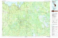
1983 Map of Munising
USGS Topo · Published 1983About this map
Munising and the adjacent Christmas serve as the primary gateways to the lakefront in this 1983 topographic survey of Alger County and the surrounding Upper Peninsula timberlands. The landscape is defined by massive federal and state land holdings, including the Pictured Rocks National Lakeshore stretching east along the Lake Superior coast and the sprawling Hiawatha National Forest. Inland, a dense network of small lakes like AuTrain Lake and Cusino Lake are interspersed with specialized industry markers such as Gravel Pits and various pipelines.
Find a feature on this map
87 named features on this map. Tap any name to fly to it.
Don’t see what you’re looking for? This feature index may not catch every label — zoom into the map to look around manually.
Map Details
Editions of this 1983 Munising Map
2 editions found
Other maps of this area

1931 · Cooks NE
USGS Topo · 1:31,680

1931 · Seney SW
USGS Topo · 1:31,680

1931 · Seney NW
USGS Topo · 1:31,680

1931 · Steuben SE
USGS Topo · 1:31,680

1931 · Manistique River NE
USGS Topo · 1:31,680

1931 · Steuben SW
USGS Topo · 1:31,680

1931 · Driggs Lake NE
USGS Topo · 1:31,680

1931 · Steuben NE
USGS Topo · 1:31,680

1931 · Cooks NW
USGS Topo · 1:31,680

1931 · Shingleton SW
USGS Topo · 1:31,680