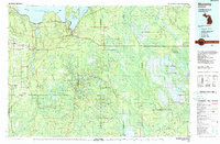
1983 Map of Munising
USGS Topo · Published 1983About this map
Munising serves as the gateway to the northern coastline on this 1983 edition, where the industrial presence of the Soo Line and Lake Superior and Ishpeming railroads meets the protected reaches of Pictured Rocks National Lakeshore. The map documents a landscape defined by massive public land holdings, including the Hiawatha National Forest and Seney National Wildlife Refuge.
Find a feature on this map
148 named features on this map. Tap any name to fly to it.
Don’t see what you’re looking for? This feature index may not catch every label — zoom into the map to look around manually.
Map Details
Editions of this 1983 Munising Map
2 editions found

Other maps of this area

1931 · Cooks NE
USGS Topo · 1:31,680

1931 · Seney SW
USGS Topo · 1:31,680

1931 · Seney NW
USGS Topo · 1:31,680

1931 · Steuben SE
USGS Topo · 1:31,680

1931 · Manistique River NE
USGS Topo · 1:31,680

1931 · Steuben SW
USGS Topo · 1:31,680

1931 · Driggs Lake NE
USGS Topo · 1:31,680

1931 · Steuben NE
USGS Topo · 1:31,680

1931 · Cooks NW
USGS Topo · 1:31,680

1931 · Shingleton SW
USGS Topo · 1:31,680