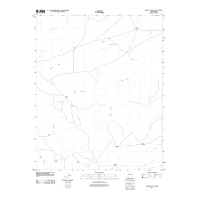
2010 Map of Muniz Canyon
USGS Topo · Published 2010About this map
Mesa Rica defines the northern landscape of this San Miguel County region, where the high ground drops into a complex network of drainages. The rangeland economy of the early 21st century is evident through numerous water management features essential for livestock, such as Muniz Tank, Middle Tank, and Feed Pasture Tank. This network of tanks and windmills suggests a continued reliance on traditional grazing practices across the varied terrain of Vigil Canyon and Muniz Canyon.
Find a feature on this map
26 named features on this map. Tap any name to fly to it.
Don’t see what you’re looking for? This feature index may not catch every label — zoom into the map to look around manually.
Map Details
Editions of this 2010 Muniz Canyon Map
This is the sole edition of this map. No revisions or reprints were ever made.
Other maps of this area

1930 · Tucumcari
USGS Topo · 1:125,000

1954 · Santa Fe
USGS Topo · 1:250,000

1954 · Tucumcari
USGS Topo · 1:250,000

1958 · Santa Fe
USGS Topo · 1:250,000

1958 · Tucumcari
USGS Topo · 1:250,000

1964 · Muniz Canyon
USGS Topo · 1:24,000

1964 · Gate Canyon
USGS Topo · 1:24,000
1964 · Montoya
USGS Topo · 1:24,000

1964 · Ortega Tank
USGS Topo · 1:24,000

1967 · Tenaja Mesa
USGS Topo · 1:24,000