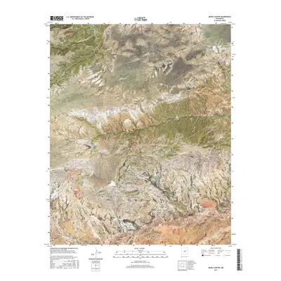
2017 Map of Muniz Canyon
USGS Topo · Published 2017About this map
Mesa Rica dominates the northern landscape of this region, serving as a high-elevation plateau that divides several drainage systems. Below its slopes, a network of canyons including Muniz Canyon, Vigil Canyon, and Ortega Canyon cut through the terrain, illustrating the complex erosion patterns common in the high plains of Eastern New Mexico. The boundary between San Miguel and Quay counties bisects the area diagonally, a line marked by the transition from upland mesas to the lower basins fed by ephemeral waterways.
Find a feature on this map
23 named features on this map. Tap any name to fly to it.
Don’t see what you’re looking for? This feature index may not catch every label — zoom into the map to look around manually.
Map Details
Editions of this 2017 Muniz Canyon Map
This is the sole edition of this map. No revisions or reprints were ever made.
Other maps of this area

1930 · Tucumcari
USGS Topo · 1:125,000

1954 · Santa Fe
USGS Topo · 1:250,000

1954 · Tucumcari
USGS Topo · 1:250,000

1958 · Santa Fe
USGS Topo · 1:250,000

1958 · Tucumcari
USGS Topo · 1:250,000

1964 · Muniz Canyon
USGS Topo · 1:24,000

1964 · Gate Canyon
USGS Topo · 1:24,000
1964 · Montoya
USGS Topo · 1:24,000

1964 · Ortega Tank
USGS Topo · 1:24,000

1967 · Tenaja Mesa
USGS Topo · 1:24,000