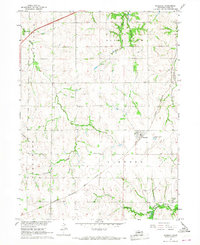
1966 Map of Murdock
USGS Topo · Published 1967About this map
Murdock stands as a focal point in this mid-1960s survey of western Cass County, situated at the junction of the Chicago and Rock Island railroad line and local section roads. The landscape is defined by the branching drainages of Salt Creek and Callahan Creek, which carve through the agricultural tablelands of the South Bend and Elmwood precincts. This period reveals a rural community supported by a network of local landmarks, including the Callahan Ch and several family or community burial grounds like Hill Cem and Callahan Cem.
Find a feature on this map
21 named features on this map. Tap any name to fly to it.
Don’t see what you’re looking for? This feature index may not catch every label — zoom into the map to look around manually.
Map Details
Editions of this 1966 Murdock Map
2 editions found
Other maps of this area

1893 · Fremont
USGS Topo · 1:125,000

1896 · Fremont
USGS Topo · 1:125,000

1903 · Weeping Water
USGS Topo · 1:125,000

1929 · Weeping Water
USGS Topo · 1:125,000

1955 · Fremont
USGS Topo · 1:250,000

1955 · Lincoln
USGS Topo · 1:250,000

1956 · Springfield
USGS Topo · 1:24,000

1957 · Fremont
USGS Topo · 1:250,000

1957 · Lincoln
USGS Topo · 1:250,000

1958 · Fremont
USGS Topo · 1:250,000