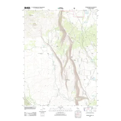
2012 Map of Murken Bench
USGS Topo · Published 2012About this map
The volcanic topography of Shasta County is defined here by the steep ascent of the Hat Creek Rim, a dramatic fault scarp that overlooks the water-scarce landscape below. Standing atop this elevation, the Hat Creek Rim Lookout provides a vantage point over a terrain shaped by ancient eruptions, including the nearby Cinder Butte. Scientific interests are represented by the presence of the University of California Observatory, which utilizes the high elevation and clear skies of this region for astronomical research.
Find a feature on this map
48 named features on this map. Tap any name to fly to it.
Don’t see what you’re looking for? This feature index may not catch every label — zoom into the map to look around manually.
Map Details
Editions of this 2012 Murken Bench Map
This is the sole edition of this map. No revisions or reprints were ever made.
Other maps of this area

1886 · Lassen Peak
USGS Topo · 1:250,000

1892 · Lassen Peak
USGS Topo · 1:250,000

1894 · Lassen Peak
USGS Topo · 1:250,000

1935 · Burney
USGS Topo · 1:96,000

1939 · Burney
USGS Topo · 1:125,000

1939 · Halls Flat
USGS Topo · 1:125,000

1955 · Westwood
USGS Topo · 1:250,000

1956 · Manzanita Lake
USGS Topo · 1:62,500

1957 · Prospect Peak
USGS Topo · 1:62,500

1957 · Burney
USGS Topo · 1:62,500