2022 Map of Murphy
USGS Topo · Published 2022About this map
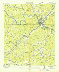
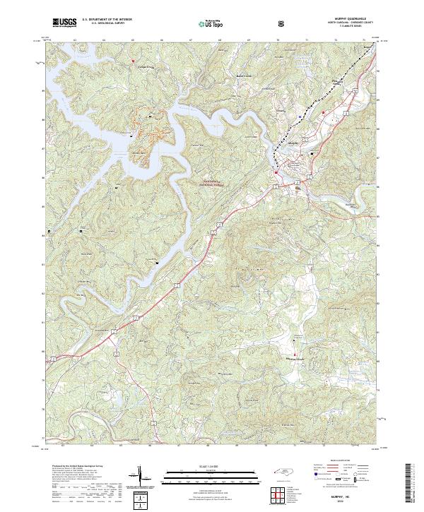
The town of Murphy serves as the focal point of this survey, where the Hiwassee River and Valley River converge near the Cherokee County Courthouse. This river confluence has historically shaped the settlement patterns of western North Carolina, with the landscape transitioning from the urban center to the protected expanses of the Nantahala National Forest. The map detail reveals a high density of small family and community burial grounds, such as Clounts Cem and Sunset Cem, which are invaluable for genealogical research in this Appalachian corridor.
Find a feature on this map
126 named features on this map. Tap any name to fly to it.
Don’t see what you’re looking for? This feature index may not catch every label — zoom into the map to look around manually.
Map Details
Editions of this 2022 Murphy Map
This is the sole edition of this map. No revisions or reprints were ever made.
Historical Maps of Murphy Through Time
6 maps found