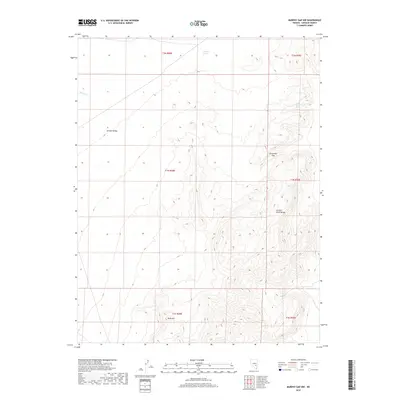
2018 Map of Murphy Gap NW
USGS Topo · Published 2018About this map
Golden Gate Range dominates the eastern half of this terrain, where steep contour lines reveal the dramatic verticality of the Nevada desert. This 2018 survey documents a remote section of Lincoln County, characterized by high-elevation landforms and vital water sources in an arid landscape. Garden Valley spreads across the northwest, providing a lower-elevation expanse that contrasts with the surrounding ridges. The survival of life in this environment is signaled by isolated water points like Put Back Spring, Little Davis Spring, and the seasonal flow of Barton Cr. Natural corridors through the range are marked by locations such as Cottontail Pass, which provides a navigable route through the mountain spine. To the south, the solitary prominence of Rock Hill stands apart from the main range, serving as a distinct navigational landmark within the township and range grid system.
Find a feature on this map
13 named features on this map. Tap any name to fly to it.
Don’t see what you’re looking for? This feature index may not catch every label — zoom into the map to look around manually.
Map Details
Editions of this 2018 Murphy Gap NW Map
This is the sole edition of this map. No revisions or reprints were ever made.
Other maps of this area

1942 · Penoyer Valley
USGS Topo · 1:125,000

1954 · Caliente
USGS Topo · 1:250,000

1956 · Lund
USGS Topo · 1:250,000

1959 · Caliente
USGS Topo · 1:250,000

1960 · Lund
USGS Topo · 1:250,000

1985 · Worthington Peak
USGS Topo · 1:24,000

1985 · Water Gap East
USGS Topo · 1:24,000

1985 · Coal Valley Reservoir
USGS Topo · 1:24,000

1985 · Murphy Gap
USGS Topo · 1:24,000

1985 · Murphy Gap NW
USGS Topo · 1:24,000