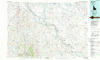
1986 Map of Murphy
USGS Topo · Published 1986About this map
Silver City and De Lamar anchor the high country of the Owyhee Mountains, reflecting the enduring legacy of the regional mining era during the mid-1980s. This survey records a landscape shaped by both extraction and conservation, featuring numerous historical claims like the Wahl Mine, Oro Fino Mine, and Morning Star Mine. The Snake River carves a deep path through the center of the sheet, defining the boundary of the Snake River Birds Of Prey National Conservation Area. North of the river, the irrigation infrastructure of the Mora Canal and New York Canal supports the agricultural growth near Melba and Bowmont. Notable landmarks such as Initial Point—the principal reference for Idaho surveying—and the State Penitentiary near the northern border highlight the intersection of government, law, and geography in the Boise Basin.
Find a feature on this map
61 named features on this map. Tap any name to fly to it.
Don’t see what you’re looking for? This feature index may not catch every label — zoom into the map to look around manually.
Map Details
Editions of this 1986 Murphy Map
This is the sole edition of this map. No revisions or reprints were ever made.
Other maps of this area

1892 · Mountain Home
USGS Topo · 1:125,000

1892 · Boise
USGS Topo · 1:125,000

1892 · Bisuka
USGS Topo · 1:125,000

1892 · Silver City
USGS Topo · 1:125,000

1893 · Mountain Home
USGS Topo · 1:125,000

1894 · Bisuka
USGS Topo · 1:125,000

1894 · Silver City
USGS Topo · 1:125,000

1894 · Idaho Basin
USGS Topo · 1:125,000

1897 · Boise
USGS Topo · 1:125,000

1898 · Nampa
USGS Topo · 1:125,000