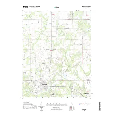
2018 Map of Murphysboro
USGS Topo · Published 2018About this map
Murphysboro serves as the focal point of this Jackson County survey, situated just north of the Big Muddy River. The landscape reveals a transition from the urban grid of the city to the industrial and agricultural corridors of Harrison and Mount Carbon. The river's winding path dictates the local geography, feeding into Borgsmiller Lake and Browns Lake, while the western edge is defined by the recreation and water resources of Lake Murphysboro.
Find a feature on this map
123 named features on this map. Tap any name to fly to it.
Don’t see what you’re looking for? This feature index may not catch every label — zoom into the map to look around manually.
Map Details
Editions of this 2018 Murphysboro Map
This is the sole edition of this map. No revisions or reprints were ever made.
Other maps of this area

1910 · Herrin
USGS Topo · 1:62,500

1910 · Murphysboro
USGS Topo · 1:62,500

1922 · Carbondale
USGS Topo · 1:62,500

1924 · Alto Pass
USGS Topo · 1:62,500

1936 · Herrin
USGS Topo · 1:62,500

1938 · Murphysboro
USGS Topo · 1:62,500

1941 · Carbondale
USGS Topo · 1:62,500

1947 · Alto Pass
USGS Topo · 1:62,500

1947 · Gorham
USGS Topo · 1:24,000
1948 · Gorham
USGS Topo · 1:24,000