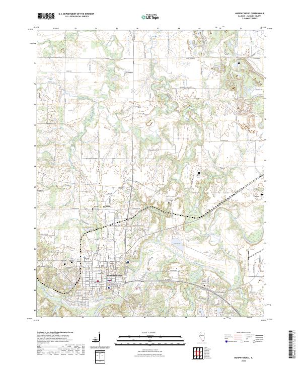
2024 Map of Murphysboro
USGS Topo · Published 2024About this map
Murphysboro serves as the focal point of this Jackson County landscape, situated where the Big Muddy River winds through the southern Illinois countryside. The presence of the Jackson County Courthouse anchors the city's central district, surrounded by several long-established burial grounds including Murphysboro City Cem, Saint Andrews Cem, and Tower Grove Cem. The map reveals a dense network of rural roads and residential development extending north toward the settlement of Harrison. Outside the city center, the terrain is defined by the confluence of major waterways like Beaucoup Creek and Pond Creek, alongside smaller water bodies such as Borgsmiller Lake and Browns Lake. This contemporary survey details a mix of municipal infrastructure, industrial zones like E Industrial Park Rd, and outlying landmarks including Zion Lutheran Cem and Murdale Gardens of Memory.
Find a feature on this map
143 named features on this map. Tap any name to fly to it.
Don’t see what you’re looking for? This feature index may not catch every label — zoom into the map to look around manually.
Map Details
Editions of this 2024 Murphysboro Map
This is the sole edition of this map. No revisions or reprints were ever made.
Historical Maps of Texas Junction Through Time
4 maps found