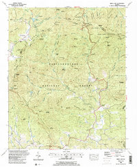
1964 Map of Murrayville
USGS Topo · Published 1986About this map
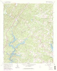
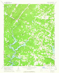
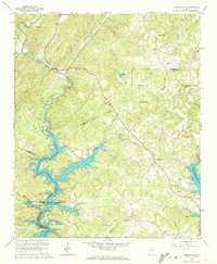
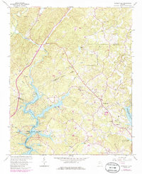
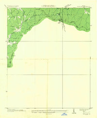
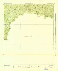
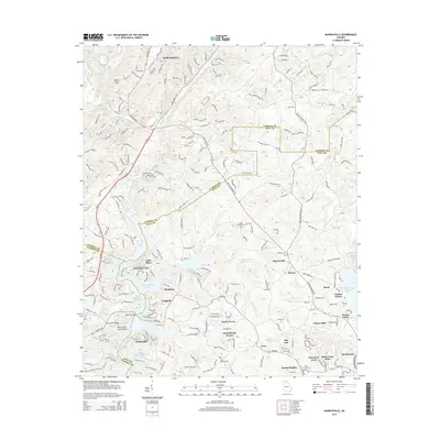
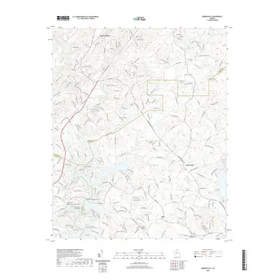
Calhoun Gold Mine sits near the northern boundary of this survey, a reminder of the gold mining history that shaped this section of northern Georgia. The landscape is dominated by the complex, branching fingers of Lake Sidney Lanier, particularly where it meets the Chestatee River. The creation of the reservoir altered the local geography, visible here in the submerged contours and the presence of new facilities like the Toto Creek Recreation Site and the Woodmen of the World Youth Camp. Local life centers around rural crossroads and spiritual hubs such as Murrayville, Hickory Grove Ch, and Soules Chapel. The mapping also reveals a dense network of named creeks, including Little Yellow Creek and Wahoo Creek, which feed into the main waterway. This 1985 revision tracks the expansion of local infrastructure like the Toto Creek Bridge and the Lanier Sch.
Find a feature on this map
41 named features on this map. Tap any name to fly to it.
Don’t see what you’re looking for? This feature index may not catch every label — zoom into the map to look around manually.
Map Details
Editions of this 1964 Murrayville Map
4 editions found
Historical Maps of Dahlonega Through Time
21 maps found
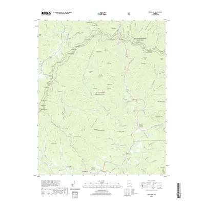
1935 Neels Gap
Lumpkin County, GA
1938 Neels Gap
Lumpkin County, GA
1950 Campbell Mtn
Lumpkin County, GA
1950 Neels Gap
Lumpkin County, GA
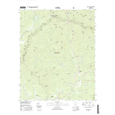
1964 Murrayville
Lumpkin County, GA
1988 Neels Gap
Lumpkin County, GA
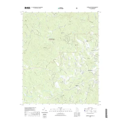
2011 Campbell Mountain
Lumpkin County, GA

2011 Murrayville
Lumpkin County, GA
2011 Neel Gap
Lumpkin County, GA
2014 Campbell Mountain
Lumpkin County, GA
2014 Murrayville
Lumpkin County, GA
2014 Neel Gap
Lumpkin County, GA
2017 Campbell Mountain
Lumpkin County, GA
2017 Murrayville
Lumpkin County, GA
2017 Neel Gap
Lumpkin County, GA
2020 Campbell Mountain
Lumpkin County, GA
2020 Murrayville
Lumpkin County, GA
2020 Neel Gap
Lumpkin County, GA
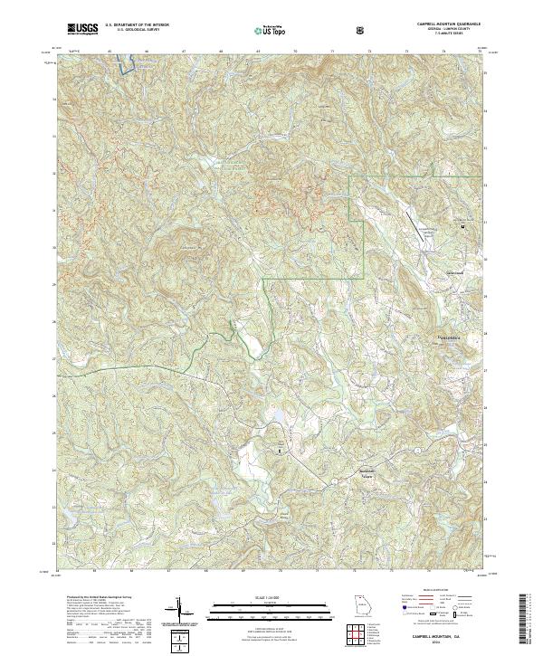
2024 Campbell Mountain
Lumpkin County, GA
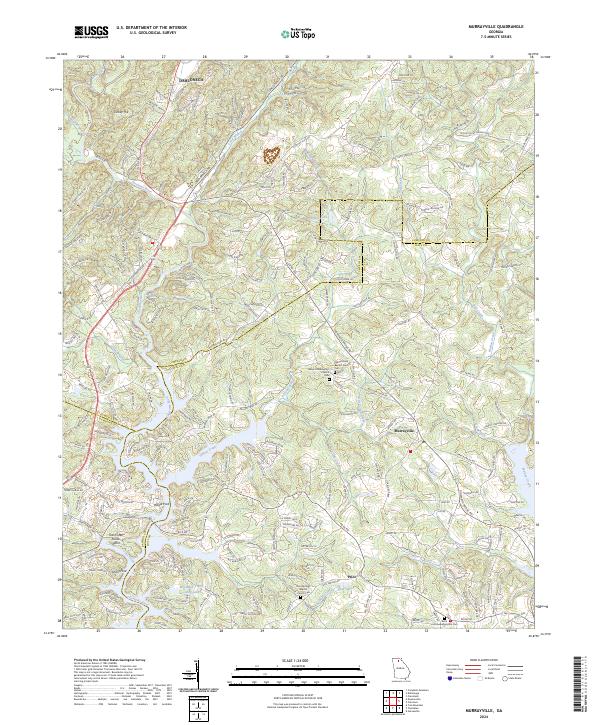
2024 Murrayville
Lumpkin County, GA
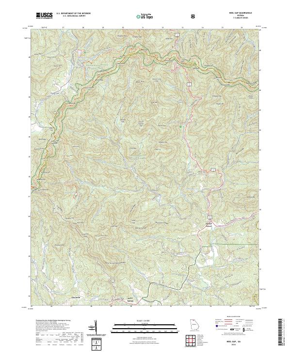
2024 Neel Gap
Lumpkin County, GA