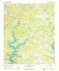
1964 Map of Murrayville
USGS Topo · Published 1972About this map
Lake Sidney Lanier dominates the lower landscape of this mid-1960s survey, its fingers reaching into the valleys where the Chestatee River and Yellow Creek once flowed freely. The rising waters of the reservoir have reshaped the terrain at the tri-county junction of Lumpkin, Hall, and Dawson, though the high ground remains dotted with the small community hubs of Murrayville and Price. A significant historical landmark, the Calhoun Gold Mine, stands near the northern bank of the Chestatee, a remnant of the region's earlier industrial ventures.
Find a feature on this map
38 named features on this map. Tap any name to fly to it.
Don’t see what you’re looking for? This feature index may not catch every label — zoom into the map to look around manually.
Map Details
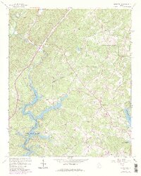
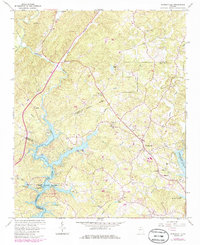
Editions of this 1964 Murrayville Map
4 editions found

Other maps of this area

1886 · Dahlonega
USGS Topo · 1:125,000

1888 · Ellijay
USGS Topo · 1:125,000

1890 · Suwanee
USGS Topo · 1:125,000

1891 · Gainesville
USGS Topo · 1:125,000

1892 · Dahlonega
USGS Topo · 1:125,000

1892 · Ellijay
USGS Topo · 1:125,000

1894 · Suwanee
USGS Topo · 1:125,000

1896 · Dahlonega
USGS Topo · 1:125,000

1898 · Ellijay
USGS Topo · 1:125,000

1903 · Dahlonega
USGS Topo · 1:125,000