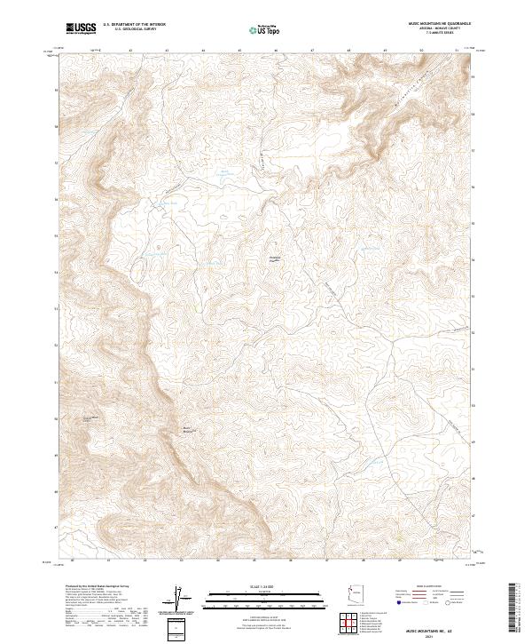
2021 Map of Music Mountains NE
USGS Topo · Published 2021About this map
Grand Wash Cliffs and the Music Mountains define this high-altitude landscape in the northwestern corner of Arizona. This region, centered on the Hualapai Plateau, is characterized by significant topographical shifts and a network of remote ranching or service roads. The map reveals a land management pattern reliant on localized water sources such as Black Canyon Tank, Jamison Tank, and Silt Tank. These artificial or improved natural catchments are essential for sustaining activity across these arid uplands. Long-established routes like Buck and Doe Rd and Meriwhitica Rd navigate the uneven terrain, providing access to Meriwhitica Canyon. The presence of Clay Springs suggests one of the few natural perennial water points in a landscape otherwise dominated by seasonal drainage and high plateau scrub.
Find a feature on this map
19 named features on this map. Tap any name to fly to it.
Don’t see what you’re looking for? This feature index may not catch every label — zoom into the map to look around manually.
Map Details
Editions of this 2021 Music Mountains NE Map
This is the sole edition of this map. No revisions or reprints were ever made.
Other maps of this area

1886 · Diamond Creek
USGS Topo · 1:250,000

1892 · Diamond Creek
USGS Topo · 1:250,000

1948 · Williams
USGS Topo · 1:250,000

1954 · Williams
USGS Topo · 1:250,000

1956 · Williams
USGS Topo · 1:250,000

1960 · Williams
USGS Topo · 1:250,000

1961 · Williams
USGS Topo · 1:250,000

1967 · Milkweed Canyon SW
USGS Topo · 1:24,000
1967 · Milkweed Canyon NW
USGS Topo · 1:24,000
1967 · Spencer Canyon
USGS Topo · 1:24,000