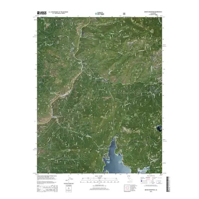
2015 Map of Musick Mountain
USGS Topo · Published 2015About this map
The San Joaquin River carves a deep path through this high-elevation landscape of the Sierra National Forest, defining the border between Madera and Fresno counties. The map captures the industrial and recreational character of the region, from the hydroelectric infrastructure at Dam Six Lake and Big Creek to the established mountain retreats at Camp Sierra and Rock Haven. Transport patterns are revealed by historical markers like Old RR Grade Rd and the winding Million Dollar Rd, tracing the challenging terrain of the Sierra Nevada. Prominent granite landmarks such as Mushroom Rock and Musick Mountain tower over the drainage basins of Stevenson Cr and Big Cr, which eventually feed into the southern reaches of Shaver Lake. This survey illustrates how the rugged central Sierras were navigated and utilized for both water power and seasonal habitation.
Find a feature on this map
46 named features on this map. Tap any name to fly to it.
Don’t see what you’re looking for? This feature index may not catch every label — zoom into the map to look around manually.
Map Details
Editions of this 2015 Musick Mountain Map
This is the sole edition of this map. No revisions or reprints were ever made.
Other maps of this area

1904 · Kaiser
USGS Topo · 1:125,000

1947 · Mariposa
USGS Topo · 1:250,000

1948 · Mariposa
USGS Topo · 1:250,000

1953 · Huntington Lake
USGS Topo · 1:62,500

1953 · Shaver Lake
USGS Topo · 1:62,500

1953 · Shuteye Peak
USGS Topo · 1:62,500

1953 · Kaiser Peak
USGS Topo · 1:62,500

1957 · Mariposa
USGS Topo · 1:250,000

1963 · Mariposa
USGS Topo · 1:250,000

1980 · Shaver Lake
USGS Topo · 1:100,000