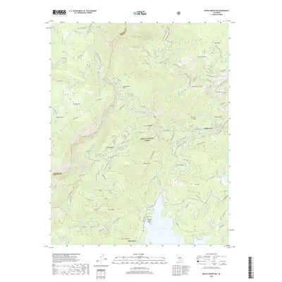
2018 Map of Musick Mountain
USGS Topo · Published 2018About this map
Shaver Lake and the high elevations of the Sierra National Forest define this 2018 study of the central California mountains. The landscape is a complex network of hydroelectric and industrial infrastructure, notably the Mammoth Power House and the engineering of Dam Six Lake on the San Joaquin River. Historical transit and extraction are evident in the trace of the S J & E Railroad Grade and the S.J. Mines located near the northern boundary. Small settlements like Camp Sierra, Rock Haven, and Shaver Lake Point provide anchor points for those tracing local development and recreational history. From the heights of Musick Mtn to the depths of Big Creek Canyon, the map preserves the names of distinct terrain features such as Kinsman Flat and Mushroom Rock, documenting a region where timber, power, and water management have long shaped the land.
Find a feature on this map
58 named features on this map. Tap any name to fly to it.
Don’t see what you’re looking for? This feature index may not catch every label — zoom into the map to look around manually.
Map Details
Editions of this 2018 Musick Mountain Map
This is the sole edition of this map. No revisions or reprints were ever made.
Other maps of this area

1904 · Kaiser
USGS Topo · 1:125,000

1947 · Mariposa
USGS Topo · 1:250,000

1948 · Mariposa
USGS Topo · 1:250,000

1953 · Huntington Lake
USGS Topo · 1:62,500

1953 · Shaver Lake
USGS Topo · 1:62,500

1953 · Shuteye Peak
USGS Topo · 1:62,500

1953 · Kaiser Peak
USGS Topo · 1:62,500

1957 · Mariposa
USGS Topo · 1:250,000

1963 · Mariposa
USGS Topo · 1:250,000

1980 · Shaver Lake
USGS Topo · 1:100,000