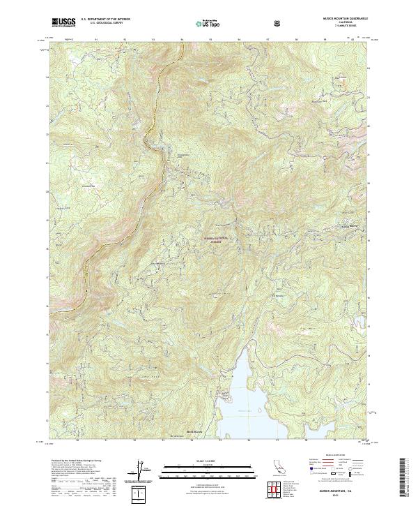
2021 Map of Musick Mountain
USGS Topo · Published 2021About this map
Shaver Lake dominates the southern reaches of this high-elevation landscape, where the waters of Stevenson Creek are impounded for hydroelectric power and recreation. The San Joaquin River carves through the northern canyons, supported by industrial infrastructure like the Mammoth Power House and Dam Six Lake. This terrain has long been a corridor for resource extraction and mountain transit, evidenced by the S J B E Railroad Grade and numerous historical spurs such as Deadwood Bullet Spur and Termite Spur. Small enclaves and seasonal camps like Camp Sierra, Rock Haven, and Chawanakee Flats are tucked into the drainages of Big Creek and Alder Gulch. High points like Musick Mtn and Mushroom Rock overlook a complex network of forest roads and trails, including the Stump Springs Trail, which trace the ridges between the Madera and Fresno County lines.
Find a feature on this map
53 named features on this map. Tap any name to fly to it.
Don’t see what you’re looking for? This feature index may not catch every label — zoom into the map to look around manually.
Map Details
Editions of this 2021 Musick Mountain Map
This is the sole edition of this map. No revisions or reprints were ever made.
Other maps of this area

1904 · Kaiser
USGS Topo · 1:125,000

1947 · Mariposa
USGS Topo · 1:250,000

1948 · Mariposa
USGS Topo · 1:250,000

1953 · Huntington Lake
USGS Topo · 1:62,500

1953 · Shaver Lake
USGS Topo · 1:62,500

1953 · Shuteye Peak
USGS Topo · 1:62,500

1953 · Kaiser Peak
USGS Topo · 1:62,500

1957 · Mariposa
USGS Topo · 1:250,000

1963 · Mariposa
USGS Topo · 1:250,000

1980 · Shaver Lake
USGS Topo · 1:100,000