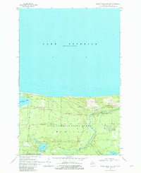
1968 Map of Muskallonge Lake East
USGS Topo · Published 1982About this map
Lake Superior State Forest dominates this coastal landscape along the southern shore of Lake Superior. The terrain is defined by the winding course of the Two Hearted River, which flows through the eastern half of the township of McMillan. This area serves as a significant intersection of recreational and industrial history, where an Old Railroad Grade cuts through the forest south of Reed and Green Bridge Campground.
Find a feature on this map
21 named features on this map. Tap any name to fly to it.
Don’t see what you’re looking for? This feature index may not catch every label — zoom into the map to look around manually.
Map Details
Editions of this 1968 Muskallonge Lake East Map
2 editions found
Other maps of this area

1954 · Sault Sainte Marie
USGS Topo · 1:250,000

1956 · Sault Sainte Marie
USGS Topo · 1:250,000

1957 · Sault Sainte Marie
USGS Topo · 1:250,000

1958 · Sault Sainte Marie
USGS Topo · 1:250,000

1968 · Muskallonge Lake East
USGS Topo · 1:24,000

1968 · Muskallonge Lake SW
USGS Topo · 1:24,000

1968 · Muskallonge Lake West
USGS Topo · 1:24,000

1968 · Muskallonge Lake SE
USGS Topo · 1:24,000

1968 · Betsy Lake NW
USGS Topo · 1:24,000

1968 · Betsy Lake SW
USGS Topo · 1:24,000