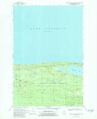
1968 Map of Muskallonge Lake West
USGS Topo · Published 1982About this map
The southern shore of Lake Superior dominates this portion of McMillan Township, where the lake's vast waters meet the dense woodlands of the Lake Superior State Forest. This 1968 field-checked survey highlights the transition between the open water and a complex system of interior wetlands and smaller lakes. Most prominent is Muskallonge Lake State Park, which serves as a gateway for recreation with its Campground and Boat Ramp on the shores of Muskallonge Lake.
Find a feature on this map
23 named features on this map. Tap any name to fly to it.
Don’t see what you’re looking for? This feature index may not catch every label — zoom into the map to look around manually.
Map Details
Editions of this 1968 Muskallonge Lake West Map
2 editions found
Other maps of this area

1954 · Sault Sainte Marie
USGS Topo · 1:250,000

1956 · Sault Sainte Marie
USGS Topo · 1:250,000

1957 · Sault Sainte Marie
USGS Topo · 1:250,000

1958 · Sault Sainte Marie
USGS Topo · 1:250,000

1968 · Muskallonge Lake East
USGS Topo · 1:24,000

1968 · Muskallonge Lake SW
USGS Topo · 1:24,000

1968 · Muskallonge Lake West
USGS Topo · 1:24,000

1968 · Muskallonge Lake SE
USGS Topo · 1:24,000
1968 · Grand Marais SE
USGS Topo · 1:24,000
1968 · Grand Marais NE
USGS Topo · 1:24,000