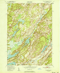
1951 Map of Muskalonge Lake
USGS Topo · Published 1951About this map
Muskalonge Lake and the surrounding high country of Jefferson Co and ST Lawrence Co define this landscape, where early postwar rural life is documented through a dense network of district schools and crossroad hamlets. The settlement at Oxbow sits near the sharp bend of the Indian River, serving as a focal point for local history alongside smaller clusters like Nelson Corners and Chapel Corners.
Find a feature on this map
33 named features on this map. Tap any name to fly to it.
Don’t see what you’re looking for? This feature index may not catch every label — zoom into the map to look around manually.
Map Details
Editions of this 1951 Muskalonge Lake Map
This is the sole edition of this map. No revisions or reprints were ever made.
Other maps of this area

1903 · Alexandria Bay
USGS Topo · 1:62,500

1903 · Theresa
USGS Topo · 1:62,500

1911 · Antwerp
USGS Topo · 1:62,500

1912 · Hammond
USGS Topo · 1:62,500

1943 · Redwood
USGS Topo · 1:31,680

1944 · Hammond
USGS Topo · 1:62,500

1948 · Theresa
USGS Topo · 1:24,000

1948 · Chippewa Bay
USGS Topo · 1:24,000
1948 · Theresa
USGS Topo · 1:62,500

1948 · Alexandria Bay
USGS Topo · 1:62,500