Loading...
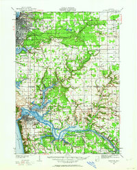
Loading map...1930 Map of Muskegon
USGS Topo · Published 1964About this map
Muskegon and its southern neighboring communities appear here as they were shaped by the industrial and maritime expansion of the late 1920s. The landscape is defined by the intricate water systems feeding into Lake Michigan, notably the winding Grand River with its numerous named inlets like Deremo Bayou and Pottawattomie Bayou. The Pere Marquette rail lines provide the primary infrastructure for the region, connecting industrial hubs like Muskegon Heights with the lakeshore.
Find a feature on this map
92 named features on this map. Tap any name to fly to it.
Don’t see what you’re looking for? This feature index may not catch every label — zoom into the map to look around manually.
Map Details
Date Portrayed1930
Date Published1964
PublisherU.S. Geological Survey
Map TypeTopographic
Scale1:62,500
Physical Dimensions17 x 21 inches
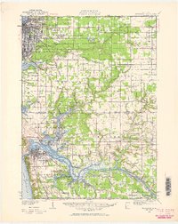
Editions of this 1930 Muskegon Map
2 editions found
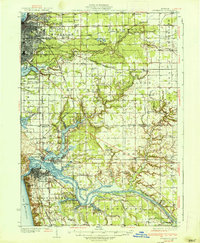
Historical Maps of Muskegon Through Time
3 maps found

Featured Locations
Source Details
SourceU.S. Geological Survey
CopyrightPublic Domain