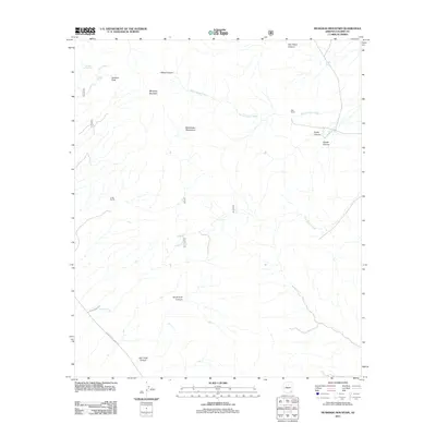
2011 Map of Muskhog Mountain
USGS Topo · Published 2011About this map
Muskhog Mountain and the Winchester Mountains dominate this high-desert landscape in northern Cochise County. The terrain is defined by a dense network of drainage systems, including Wood Canyon Wash, Bear Creek, and Bee Canyon Wash, which carve through various named canyons such as Oak Grove Canyon and Ash Creek Canyon. Human presence is sparse and tied to ranching and water management, evidenced by the G Bar Ranch and Ellis Ranch. Essential water sources like Javelina Spring and man-made features such as Cement Dam Tank and Fulghum Tank underscore the importance of water rights in this arid environment. Transportation is limited to rugged corridors like N Cascabel Rd and N Muleshoe Ranch Rd, providing access to the higher elevations of Javelina Peak and the surrounding wilderness areas.
Find a feature on this map
26 named features on this map. Tap any name to fly to it.
Don’t see what you’re looking for? This feature index may not catch every label — zoom into the map to look around manually.
Map Details
Editions of this 2011 Muskhog Mountain Map
This is the sole edition of this map. No revisions or reprints were ever made.
Other maps of this area

1922 · Willcox
USGS Topo · 1:125,000

1943 · Willcox
USGS Topo · 1:62,500

1943 · Cochise
USGS Topo · 1:62,500

1943 · Dragoon
USGS Topo · 1:62,500

1943 · Winchester Mts.
USGS Topo · 1:62,500

1945 · Winchester Mts.
USGS Topo · 1:62,500

1954 · Silver City
USGS Topo · 1:250,000

1956 · Tucson
USGS Topo · 1:250,000

1957 · Winchester Mts.
USGS Topo · 1:62,500

1958 · Silver City
USGS Topo · 1:250,000