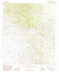
1985 Map of Muskhog Mountain
USGS Topo · Published 1985About this map
Muskhog Mountain and the high ridges of the Winchester Mountains dominate this mid-1980s topographic study of the Arizona landscape. Situated within the Coronado National Forest, the terrain is defined by a complex network of drainages including Davis Canyon, Rocky Canyon, and Severin Canyon. The presence of numerous livestock watering features like Stubbs Tank, Adobe Tank, and Fulghum Tank indicates the land's utility for ranching despite the high elevations and steep relief. To the southwest, the topography transitions into the relatively level expanse of Allen Flat, where Ash Creek and the South Fork meet. Early water sources such as Javelina Spring near Javelina Peak provide critical points of interest for those tracing the history of resource management and movement in this part of Cochise County.
Find a feature on this map
26 named features on this map. Tap any name to fly to it.
Don’t see what you’re looking for? This feature index may not catch every label — zoom into the map to look around manually.
Map Details
Editions of this 1985 Muskhog Mountain Map
This is the sole edition of this map. No revisions or reprints were ever made.
Other maps of this area

1922 · Willcox
USGS Topo · 1:125,000

1943 · Willcox
USGS Topo · 1:62,500

1943 · Cochise
USGS Topo · 1:62,500

1943 · Dragoon
USGS Topo · 1:62,500

1943 · Winchester Mts.
USGS Topo · 1:62,500

1945 · Winchester Mts.
USGS Topo · 1:62,500

1954 · Silver City
USGS Topo · 1:250,000

1956 · Tucson
USGS Topo · 1:250,000

1957 · Winchester Mts.
USGS Topo · 1:62,500

1958 · Silver City
USGS Topo · 1:250,000