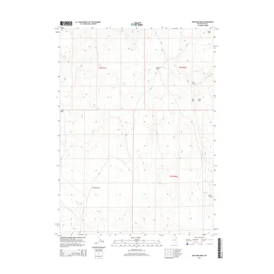
2014 Map of Mustang Draw
USGS Topo · Published 2014About this map
Mustang Spring sits at the western edge of this Elko County landscape, a vital water source in an environment defined by deep drainage patterns and high-desert terrain. The topography is marked by a series of prominent features including Mustang Draw and Big Draw, which channel seasonal runoff through the basins. Named landmarks like Tepee Rock serve as distinct visual anchors for navigating the open country.
Find a feature on this map
16 named features on this map. Tap any name to fly to it.
Don’t see what you’re looking for? This feature index may not catch every label — zoom into the map to look around manually.
Map Details
Editions of this 2014 Mustang Draw Map
This is the sole edition of this map. No revisions or reprints were ever made.
Other maps of this area

1955 · Wells
USGS Topo · 1:250,000

1958 · Wells
USGS Topo · 1:250,000

1961 · Wells
USGS Topo · 1:250,000

1961 · Delano Mountains
USGS Topo · 1:62,500

1961 · Gollaher Mountain
USGS Topo · 1:62,500

1961 · Goose Creek
USGS Topo · 1:62,500

1961 · Dairy Valley
USGS Topo · 1:62,500
1980 · Dry Canyon
USGS Topo · 1:24,000

1982 · Jackpot
USGS Topo · 1:100,000
1989 · Stratton Spring
USGS Topo · 1:24,000