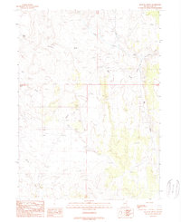
1989 Map of Mustang Draw
USGS Topo · Published 1989About this map
The Emigrant Trail carves a diagonal path through this corner of Elko County, marking a historic corridor of western movement across the high desert terrain. This landscape is defined by its drainage patterns, where Mustang Draw and Big Draw channel seasonal water toward the northeast. Reliable water sources appear as intermittent lifeblood in this arid environment, represented by Mustang Spring and several unnamed Springs found near the headwaters of Little Goose Creek. The presence of Tepee Rock serves as a distinct navigational landmark amidst the complex topography of ridges and gulches. To the south, Boulder Creek winds through the basin, illustrating the fundamental relationship between accessible water and the historic routes established by early travelers and livestock drivers in the Great Basin region.
Find a feature on this map
11 named features on this map. Tap any name to fly to it.
Don’t see what you’re looking for? This feature index may not catch every label — zoom into the map to look around manually.
Map Details
Editions of this 1989 Mustang Draw Map
This is the sole edition of this map. No revisions or reprints were ever made.
Other maps of this area

1955 · Wells
USGS Topo · 1:250,000

1958 · Wells
USGS Topo · 1:250,000

1961 · Wells
USGS Topo · 1:250,000

1961 · Delano Mountains
USGS Topo · 1:62,500

1961 · Gollaher Mountain
USGS Topo · 1:62,500

1961 · Goose Creek
USGS Topo · 1:62,500

1961 · Dairy Valley
USGS Topo · 1:62,500
1980 · Dry Canyon
USGS Topo · 1:24,000

1982 · Jackpot
USGS Topo · 1:100,000
1989 · Stratton Spring
USGS Topo · 1:24,000