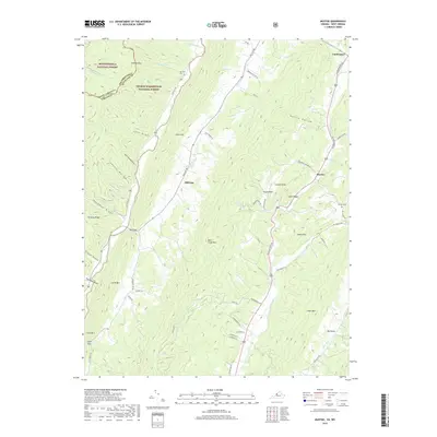
2019 Map of Mustoe
USGS Topo · Published 2019About this map
Vanderpool and Mustoe occupy the highland valleys of western Virginia in this 2019 survey of the Alleghenies. The landscape is defined by the sharp parallel ridges of Lantz Mtn, Back Creek Mtn, and Little Mtn, which channel the Jackson River and its tributaries like Back Cr and Bolar Run. This region, split between the Monongahela National Forest and George Washington National Forest, maintains a rural character with narrow access points such as Mill Gap and Lower Gap. Genealogists and local historians can find family landmarks and burial sites including Fairview Cem and Griffin Cem, alongside distinctive terrain features like Gregory Ridge, Kettle Hollow, and Big Valley. The road network, including the Jackson River Rd, follows the natural contours of the drafts and hollows, illustrating the enduring influence of the Appalachian geography on local transport.
Find a feature on this map
63 named features on this map. Tap any name to fly to it.
Don’t see what you’re looking for? This feature index may not catch every label — zoom into the map to look around manually.
Map Details
Editions of this 2019 Mustoe Map
This is the sole edition of this map. No revisions or reprints were ever made.
Other maps of this area

1901 · Monterey
USGS Topo · 1:125,000

1922 · Cass
USGS Topo · 1:48,000

1923 · Warm Springs
USGS Topo · 1:48,000

1924 · Cass
USGS Topo · 1:62,500

1926 · Warm Springs
USGS Topo · 1:62,500

1941 · Monterey
USGS Topo · 1:62,500

1944 · Monterey
USGS Topo · 1:62,500

1946 · Warm Springs
USGS Topo · 1:62,500

1946 · Williamsville
USGS Topo · 1:62,500

1949 · Charlottesville
USGS Topo · 1:250,000