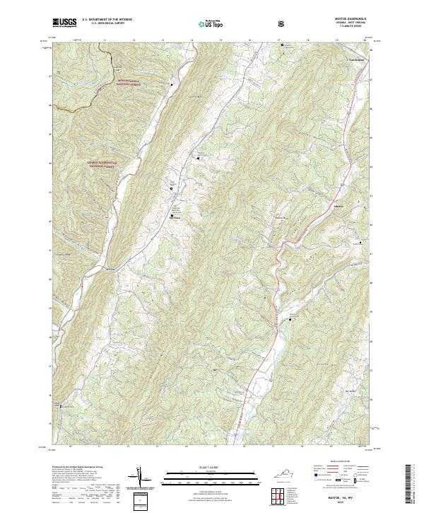
2022 Map of Mustoe
USGS Topo · Published 2022About this map
Lantz Mtn and Back Creek Mtn dominate this Highland County landscape, where the ridges of the Allegheny Mountains dictate the path of early settlements and roads. The map documents a rural community defined by family lineage and faith, centered around small hamlets like Mustoe and Vanderpool. Evidence of long-standing family ties is visible in the scattered burial grounds throughout the valleys, including the McNulty Family Cem, Wade Family Cem, and the lone Ruckman Grave near Lower Gap. The Jackson River flows through the eastern valley, paralleling the main thoroughfare, while the western reaches are largely preserved within the Monongahela National Forest and George Washington National Forest. Key community landmarks such as the Green Hill Methodist Church at Mill Gap and Wesley Chapel further south highlight the social anchors of this upland region.
Find a feature on this map
66 named features on this map. Tap any name to fly to it.
Don’t see what you’re looking for? This feature index may not catch every label — zoom into the map to look around manually.
Map Details
Editions of this 2022 Mustoe Map
This is the sole edition of this map. No revisions or reprints were ever made.
Other maps of this area

1901 · Monterey
USGS Topo · 1:125,000

1922 · Cass
USGS Topo · 1:48,000

1923 · Warm Springs
USGS Topo · 1:48,000

1924 · Cass
USGS Topo · 1:62,500

1926 · Warm Springs
USGS Topo · 1:62,500

1941 · Monterey
USGS Topo · 1:62,500

1944 · Monterey
USGS Topo · 1:62,500

1946 · Warm Springs
USGS Topo · 1:62,500

1946 · Williamsville
USGS Topo · 1:62,500

1949 · Charlottesville
USGS Topo · 1:250,000