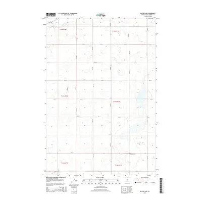
2015 Map of Mutske Lake
USGS Topo · Published 2015About this map
Hoffnungstal Cem sits as a solitary cultural landmark in the southern reaches of this Campbell County landscape, reflecting the heritage of the German-Russian settlers who established themselves in the Dakotas. The terrain is defined by the prairie pothole region's unique hydrology, dominated by the namesake Mutske Lake and the winding course of Spring Creek in the northwest. This 2015 survey illustrates a strictly organized section-line road network, including thoroughfares like 319th Ave and 321st Ave, which segment the rolling agricultural land. The map provides a clear record of rural land division and the placement of modern farmstead access points such as Rossow Pl amidst the vast open sections of T127N and T128N.
Find a feature on this map
25 named features on this map. Tap any name to fly to it.
Don’t see what you’re looking for? This feature index may not catch every label — zoom into the map to look around manually.
Map Details
Editions of this 2015 Mutske Lake Map
This is the sole edition of this map. No revisions or reprints were ever made.
Other maps of this area

1954 · Aberdeen
USGS Topo · 1:250,000

1956 · Aberdeen
USGS Topo · 1:250,000

1978 · Greenway
USGS Topo · 1:24,000

1978 · Salt Lake
USGS Topo · 1:24,000

1978 · Zeeland
USGS Topo · 1:24,000
1978 · Zeeland NW
USGS Topo · 1:24,000

1978 · Eureka West
USGS Topo · 1:24,000

1978 · Flat Lake
USGS Topo · 1:24,000

1978 · Feinstein Lake
USGS Topo · 1:24,000

1978 · Mutske Lake
USGS Topo · 1:24,000