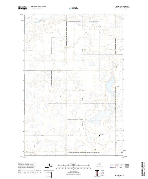
2021 Map of Mutske Lake
USGS Topo · Published 2021About this map
Spring Creek meanders through the northern section of this Campbell County landscape, part of a prairie terrain defined by numerous small depressions and wetlands. The area is surveyed under the Public Land Survey System, with township and range lines like t127n r74w dividing the agricultural grid. Local history is anchored by the Hoffnungstal Lutheran Cem and the Jacob Hoff Farm Cem, which point to the early German-Russian settlement patterns common in this part of South Dakota. In the eastern portion of the map, Mutske Lake provides a significant hydrological feature amidst the section-line roads. The transportation network is strictly rectilinear, following the established section boundaries with routes such as 112th St and 319th Ave facilitating travel between remote farmsteads.
Find a feature on this map
23 named features on this map. Tap any name to fly to it.
Don’t see what you’re looking for? This feature index may not catch every label — zoom into the map to look around manually.
Map Details
Editions of this 2021 Mutske Lake Map
This is the sole edition of this map. No revisions or reprints were ever made.
Other maps of this area

1954 · Aberdeen
USGS Topo · 1:250,000

1956 · Aberdeen
USGS Topo · 1:250,000

1978 · Greenway
USGS Topo · 1:24,000

1978 · Salt Lake
USGS Topo · 1:24,000

1978 · Zeeland
USGS Topo · 1:24,000
1978 · Zeeland NW
USGS Topo · 1:24,000

1978 · Eureka West
USGS Topo · 1:24,000

1978 · Flat Lake
USGS Topo · 1:24,000

1978 · Feinstein Lake
USGS Topo · 1:24,000

1978 · Mutske Lake
USGS Topo · 1:24,000