
1978 Map of Mutske Lake
USGS Topo · Published 1979About this map
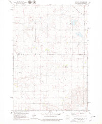
Mutske Lake and the surrounding prairie of Campbell County define this landscape as it was documented in the late 1970s. The terrain is a network of depressions and seasonal water sources, featuring several Springs and the winding course of Spring Creek. Human presence is marked by the long corridor of the Soo Line railroad cutting across the northern reaches of the quadrangle. For those researching the heritage of the Dakotas, the map identifies specific burial grounds like the Hoffnungstal Cem and an additional unnamed Cem, which offer precise locations for genealogical study. The presence of multiple Gravel Pit sites reflects the local geology and the industrial needs of road building in this rural expanse.
Find a feature on this map
9 named features on this map. Tap any name to fly to it.
Don’t see what you’re looking for? This feature index may not catch every label — zoom into the map to look around manually.
Map Details
Editions of this 1978 Mutske Lake Map
This is the sole edition of this map. No revisions or reprints were ever made.
Other maps of this area

1954 · Aberdeen
USGS Topo · 1:250,000

1956 · Aberdeen
USGS Topo · 1:250,000

1978 · Greenway
USGS Topo · 1:24,000

1978 · Salt Lake
USGS Topo · 1:24,000

1978 · Zeeland
USGS Topo · 1:24,000
1978 · Zeeland NW
USGS Topo · 1:24,000

1978 · Eureka West
USGS Topo · 1:24,000

1978 · Flat Lake
USGS Topo · 1:24,000

1978 · Feinstein Lake
USGS Topo · 1:24,000
1978 · Zeeland SW
USGS Topo · 1:24,000