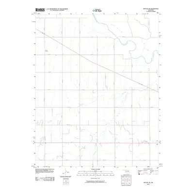
2010 Map of Mutual NE
USGS Topo · Published 2010About this map
The North Canadian River winds through this rural Oklahoma landscape, defining the northern geography with its distinctive meanders and oxbow-like bends. This terrain in Woodward County is characterized by a precise grid of sectional roads, including n2180 RD and e0550 RD, reflecting the agricultural land divisions typical of the region. A diagonal transportation corridor, carrying US Highway 270 and 183, cuts across the northern half, providing a modern contrast to the natural curves of the river and its tributaries. Local history is anchored by the Dunlap Cemetery in the northwest, a key landmark for genealogical research. The drainage patterns of Camp Creek and Bent Creek further influence the land use, creating a network of riparian corridors that interrupt the otherwise uniform fields and pastures.
Find a feature on this map
19 named features on this map. Tap any name to fly to it.
Don’t see what you’re looking for? This feature index may not catch every label — zoom into the map to look around manually.
Map Details
Editions of this 2010 Mutual NE Map
This is the sole edition of this map. No revisions or reprints were ever made.
Other maps of this area

1955 · Woodward
USGS Topo · 1:250,000

1958 · Woodward
USGS Topo · 1:250,000

1969 · Mooreland SE
USGS Topo · 1:24,000

1969 · Cedardale
USGS Topo · 1:24,000

1969 · Mooreland SW
USGS Topo · 1:24,000

1969 · Mutual SW
USGS Topo · 1:24,000

1969 · Mutual
USGS Topo · 1:24,000

1969 · Lenora
USGS Topo · 1:24,000

1969 · Mutual NE
USGS Topo · 1:24,000

1972 · Seiling
USGS Topo · 1:24,000