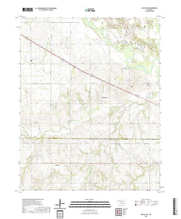
2022 Map of Mutual NE
USGS Topo · Published 2022About this map
Richmond and Cestos serve as the primary focal points of this rural landscape where the Woodward Co Dewey Co boundary line bisects the terrain. The northern portion of the quadrangle is defined by the winding course of the N Canadian River, which creates a network of wetlands and seasonal ponds. Small-scale drainage systems like Bent Cr, Camp Cr, and Kizer Cr carve through the section lines, shaping the local topography. For those researching family history in the region, the map identifies Dunlap Cem in the northwest and Richmond Cem near the river, both preserved alongside the rigid grid of county roads that have organized this part of Oklahoma since the land runs. The transition between these small settlements reflects the enduring agricultural character of the plains at the Dewey and Woodward county line.
Find a feature on this map
30 named features on this map. Tap any name to fly to it.
Don’t see what you’re looking for? This feature index may not catch every label — zoom into the map to look around manually.
Map Details
Editions of this 2022 Mutual NE Map
This is the sole edition of this map. No revisions or reprints were ever made.
Other maps of this area

1955 · Woodward
USGS Topo · 1:250,000

1958 · Woodward
USGS Topo · 1:250,000

1969 · Mooreland SE
USGS Topo · 1:24,000

1969 · Cedardale
USGS Topo · 1:24,000

1969 · Mooreland SW
USGS Topo · 1:24,000

1969 · Mutual SW
USGS Topo · 1:24,000

1969 · Mutual
USGS Topo · 1:24,000

1969 · Lenora
USGS Topo · 1:24,000

1969 · Mutual NE
USGS Topo · 1:24,000

1972 · Seiling
USGS Topo · 1:24,000