
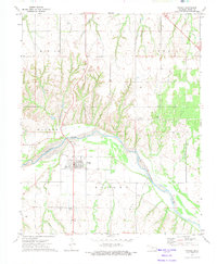
1969 Map of Mutual NE
USGS Topo · Published 1972About this map
The Old Indian Treaty Boundary bisects this landscape, marking a historical line between the townships of Webster and Simpson. This boundary reflects the complex division of land in western Oklahoma, where the North Canadian River flows through the northeast corner, accompanied by a network of drainage systems including Bent Creek and Kizer Creek. Small settlements like Richmond and Cestos serve as anchors for the surrounding rural territory, which is characterized by various pipelines and gaging infrastructure.
Find a feature on this map
17 named features on this map. Tap any name to fly to it.
Don’t see what you’re looking for? This feature index may not catch every label — zoom into the map to look around manually.
Map Details
Editions of this 1969 Mutual NE Map
This is the sole edition of this map. No revisions or reprints were ever made.
Other maps of this area

1955 · Woodward
USGS Topo · 1:250,000

1958 · Woodward
USGS Topo · 1:250,000

1969 · Mooreland SE
USGS Topo · 1:24,000

1969 · Cedardale
USGS Topo · 1:24,000

1969 · Mooreland SW
USGS Topo · 1:24,000

1969 · Mutual SW
USGS Topo · 1:24,000

1969 · Mutual
USGS Topo · 1:24,000

1969 · Lenora
USGS Topo · 1:24,000

1972 · Seiling
USGS Topo · 1:24,000
1972 · Taloga
USGS Topo · 1:24,000