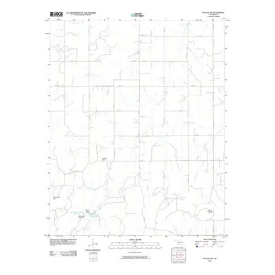
2010 Map of Mutual SW
USGS Topo · Published 2010About this map
Bloomfield Cemetery sits as a quiet focal point in this rural Dewey County landscape, surrounded by an orderly grid of section roads. The terrain is defined by a dense network of drainage, where Teepee Creek and Kizer Creek wind through the prairie to support local ranching and agriculture. This 2010 survey highlights the importance of water management in western Oklahoma, documenting several named impoundments such as Barnes Number 3 Reservoir and Oknoname 043002 Reservoir. The infrastructure of the era is clearly visible through the naming of specific water control structures, including Bryant Number 6 Dam and Mercer Number 5 Dam, which reflect the localized land use and small-scale engineering required to manage the flows of Cottonwood Creek and Camp Creek across the territory.
Find a feature on this map
29 named features on this map. Tap any name to fly to it.
Don’t see what you’re looking for? This feature index may not catch every label — zoom into the map to look around manually.
Map Details
Editions of this 2010 Mutual SW Map
This is the sole edition of this map. No revisions or reprints were ever made.
Other maps of this area

1955 · Clinton
USGS Topo · 1:250,000

1955 · Woodward
USGS Topo · 1:250,000

1957 · Clinton
USGS Topo · 1:250,000

1958 · Woodward
USGS Topo · 1:250,000

1961 · Leedey
USGS Topo · 1:62,500

1962 · Aledo
USGS Topo · 1:62,500

1969 · Mutual SW
USGS Topo · 1:24,000

1969 · Mutual
USGS Topo · 1:24,000

1969 · Lenora
USGS Topo · 1:24,000

1969 · Camargo
USGS Topo · 1:24,000