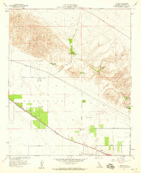
1958 Map of Myoma
USGS Topo · Published 1959About this map
Thousand Palms Oasis and the springs of the Indio Hills define the hydrology of this desert landscape in the late 1950s. The map captures a transitional period in the Coachella Valley, where agricultural outposts like Fleming Ranch and Chuckwalla Ranch operated alongside the emerging infrastructure of the Southern Pacific railroad and a growing grid of desert roads. Evidence of regional water management is prominent, including the Coachella Canal in the southeast and a large Pipeline cutting across the central plains.
Find a feature on this map
34 named features on this map. Tap any name to fly to it.
Don’t see what you’re looking for? This feature index may not catch every label — zoom into the map to look around manually.
Map Details
Editions of this 1958 Myoma Map
4 editions found
Other maps of this area

1904 · Indio
USGS Topo · 1:125,000

1941 · Toro Peak
USGS Topo · 1:62,500

1941 · Coachella
USGS Topo · 1:62,500

1941 · Edom
USGS Topo · 1:62,500

1943 · Coachella
USGS Topo · 1:62,500

1944 · Toro peak
USGS Topo · 1:62,500

1944 · Edom
USGS Topo · 1:62,500

1944 · Pinyon Well
USGS Topo · 1:62,500

1947 · Santa Ana
USGS Topo · 1:250,000

1949 · Santa Ana
USGS Topo · 1:250,000