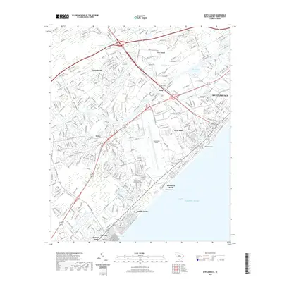
2020 Map of Myrtle Beach
USGS Topo · Published 2020About this map
Myrtle Beach and its surrounding coastal settlements are depicted here in high detail, showcasing the modern infrastructure of this South Carolina vacation destination. The map follows the coastline from Springmaid Beach down toward Surfside Beach, revealing how the landscape is divided by the Intracoastal Waterway and numerous coastal inlets like Withers Swash and Midway Swash. Behind the beachfront developments, the interior reveals a complex network of residential communities such as Forestbrook and Stalvey, alongside specialized facilities like the Golf Academy of America and the Myrtle Beach International Airport. The geography is defined by a transition from the Atlantic Ocean shore to low-lying inland areas, including Socastee Swamp and Gross Swamp. This survey provides a precise record of the road networks and urban expansion that characterize the Grand Strand area in the early twenty-first century.
Find a feature on this map
380 named features on this map. Tap any name to fly to it.
Don’t see what you’re looking for? This feature index may not catch every label — zoom into the map to look around manually.
Map Details
Editions of this 2020 Myrtle Beach Map
This is the sole edition of this map. No revisions or reprints were ever made.
Other maps of this area

1937 · Myrtle Beach
USGS Topo · 1:48,000

1937 · Nixonville
USGS Topo · 1:48,000

1940 · Myrtle Beach
USGS Topo · 1:62,500

1942 · Nixonville
USGS Topo · 1:62,500

1943 · Bucksville
USGS Topo · 1:24,000

1943 · Brookgreen
USGS Topo · 1:24,000

1943 · Conway
USGS Topo · 1:24,000

1949 · Georgetown
USGS Topo · 1:250,000

1967 · Georgetown
USGS Topo · 1:250,000

1974 · Georgetown
USGS Topo · 1:250,000