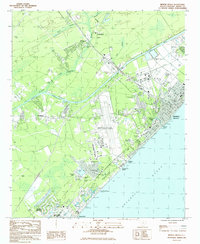
1984 Map of Myrtle Beach
USGS Topo · Published 1985About this map
Myrtle Beach Air Force Base dominates the central coastline in the mid-1980s, serving as a massive military footprint just south of the main Myrtle Beach town center. The landscape transitions from the dense resort developments and piers along the Atlantic Ocean to the industrial and swampy reaches inland. The Intracoastal Waterway cuts through the western portion of the map near Socastee, illustrating the region's reliance on both maritime transit and coastal tourism.
Find a feature on this map
35 named features on this map. Tap any name to fly to it.
Don’t see what you’re looking for? This feature index may not catch every label — zoom into the map to look around manually.
Map Details
Editions of this 1984 Myrtle Beach Map
This is the sole edition of this map. No revisions or reprints were ever made.
Other maps of this area

1937 · Myrtle Beach
USGS Topo · 1:48,000

1937 · Nixonville
USGS Topo · 1:48,000

1940 · Myrtle Beach
USGS Topo · 1:62,500

1942 · Nixonville
USGS Topo · 1:62,500

1943 · Bucksville
USGS Topo · 1:24,000

1943 · Brookgreen
USGS Topo · 1:24,000

1943 · Conway
USGS Topo · 1:24,000

1949 · Georgetown
USGS Topo · 1:250,000

1967 · Georgetown
USGS Topo · 1:250,000

1974 · Georgetown
USGS Topo · 1:250,000