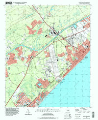
1994 Map of Myrtle Beach
USGS Topo · Published 1999About this map
Myrtle Beach and its surrounding coastal communities are captured here in the mid-1990s, showcasing the transition from inland swamp drainage to intensive seaside development. The landscape is defined by the Intracoastal Waterway cutting through the terrain, separating older settlements like Socastee and Pine Island from the burgeoning tourism hubs along the shore. The massive footprint of the Myrtle Beach International Airport stands as a central landmark, flanked by suburban growth and recreational spaces like the Myrtle Beach State Park.
Find a feature on this map
37 named features on this map. Tap any name to fly to it.
Don’t see what you’re looking for? This feature index may not catch every label — zoom into the map to look around manually.
Map Details
Editions of this 1994 Myrtle Beach Map
This is the sole edition of this map. No revisions or reprints were ever made.
Other maps of this area

1937 · Myrtle Beach
USGS Topo · 1:48,000

1937 · Nixonville
USGS Topo · 1:48,000

1940 · Myrtle Beach
USGS Topo · 1:62,500

1942 · Nixonville
USGS Topo · 1:62,500

1943 · Bucksville
USGS Topo · 1:24,000

1943 · Brookgreen
USGS Topo · 1:24,000

1943 · Conway
USGS Topo · 1:24,000

1949 · Georgetown
USGS Topo · 1:250,000

1967 · Georgetown
USGS Topo · 1:250,000

1974 · Georgetown
USGS Topo · 1:250,000