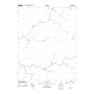
2010 Map of Myrtle
USGS Topo · Published 2010About this map
Myrtle and Belo sit along the winding path of Trace Fork, where the landscape is defined by the sharp hollows and ridges of Mingo County. This 2010 survey shows a geography deeply influenced by industrial transit and family heritage, most notably seen in the Old N W Railroad Bed Rd which follows the contours of Toms Branch and Rockhouse Branch. The area is densely populated with small family burial grounds, including the Mounts Cemeteries, Wellman Cemetery, and Marcum Cemetery, providing a significant record for genealogical research. To the north, the settlement of Dingess serves as a local hub near West Fork Twelvepole Creek, while Laurel Lake and the Laurel Lake Dam offer a rare departure from the stream-fed valleys that dominate the terrain. Smaller communities like Parsley and Scarlet are linked by mountain roads such as Parsley Dingess Rd, tracing the intricate drainage network of the Right Fork Laurel Fork.
Find a feature on this map
74 named features on this map. Tap any name to fly to it.
Don’t see what you’re looking for? This feature index may not catch every label — zoom into the map to look around manually.
Map Details
Editions of this 2010 Myrtle Map
This is the sole edition of this map. No revisions or reprints were ever made.
Other maps of this area

1887 · Warfield
USGS Topo · 1:125,000

1891 · Warfield
USGS Topo · 1:125,000

1909 · Matewan
USGS Topo · 1:48,000

1910 · Holden
USGS Topo · 1:48,000

1910 · Naugatuck
USGS Topo · 1:48,000

1912 · Naugatuck
USGS Topo · 1:62,500

1912 · Holden
USGS Topo · 1:62,500

1915 · Williamson
USGS Topo · 1:48,000

1915 · Naugatuck
USGS Topo · 1:48,000

1915 · Matewan
USGS Topo · 1:48,000