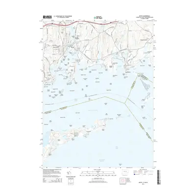
2015 Map of Mystic
USGS Topo · Published 2015About this map
Mystic Seaport anchors this maritime landscape, where the Mystic River meets the protected waters of Fishers Island Sound. The area is defined by a dense concentration of local heritage sites, from the iconic Mystic Bascule Bridge to numerous long-standing burying grounds like Elm Grove Cem and the Robinson Burial Ground. The shoreline is characterized by a complex network of points and coves, including Noank and Stonington, which evolved from early shipbuilding and fishing hubs into established coastal communities.
Find a feature on this map
161 named features on this map. Tap any name to fly to it.
Don’t see what you’re looking for? This feature index may not catch every label — zoom into the map to look around manually.
Map Details
Editions of this 2015 Mystic Map
This is the sole edition of this map. No revisions or reprints were ever made.
Other maps of this area

1889 · Stonington
USGS Topo · 1:62,500

1892 · New London
USGS Topo · 1:62,500

1893 · Stonington
USGS Topo · 1:62,500

1893 · New London
USGS Topo · 1:62,500

1903 · Gardiners Island
USGS Topo · 1:62,500

1904 · Gardiners Island
USGS Topo · 1:62,500

1904 · Montauk
USGS Topo · 1:62,500

1921 · Gardiners Island
USGS Topo · 1:62,500

1921 · New London
USGS Topo · 1:62,500

1921 · Stonington
USGS Topo · 1:62,500