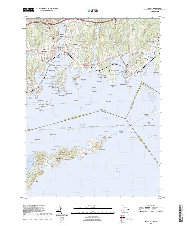
2024 Map of Mystic
USGS Topo · Published 2024About this map
Old Mystic and the harbor settlements at Mystic and Stonington anchor this coastal landscape where the Mystic River meets Long Island Sound. The map documents a dense network of maritime history, from the historic Mystic Seaport and the docks of Noank to the sprawling Fishers Island lying across the sound. The transportation corridor is dominated by the Amtrak rail line and Stonington Road, which connect the colonial-era burial grounds like Wequetequock Burying Grounds Cem and Elm Grove Cem.
Find a feature on this map
187 named features on this map. Tap any name to fly to it.
Don’t see what you’re looking for? This feature index may not catch every label — zoom into the map to look around manually.
Map Details
Editions of this 2024 Mystic Map
This is the sole edition of this map. No revisions or reprints were ever made.
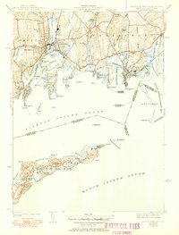
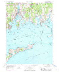
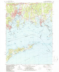
Historical Maps of Noank Through Time
4 maps found