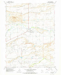
1964 Map of Myton
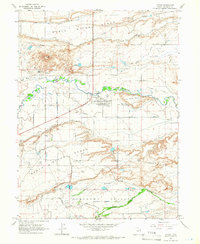
USGS Topo · Published 1978About this map
The Duchesne River winds through this high desert landscape, serving as the lifeblood for a sophisticated network of irrigation. Settled within the river valley, the town of Myton appears as a structured hub of local activity, complete with Rodeo Grounds, the Myton Airstrip, and essential infrastructure like the Myton Pumping Sta. The surrounding terrain is dominated by the broad, flat expanse of Myton Bench to the north and the deep incisions of Pleasant Valley and Wells Draw to the south. This 1960s-era survey reveals the critical role of water management in Duchesne County, mapping out numerous waterways including the North Lateral Canal, Dry Gulch Canal, and Pleasant Valley Canal. Distinctive landmarks such as Flattop Butte and Gray Mountain provide clear orientation points against the backdrop of the Uintah Basin's benchlands.
Find a feature on this map
29 named features on this map. Tap any name to fly to it.
Don’t see what you’re looking for? This feature index may not catch every label — zoom into the map to look around manually.
Map Details
Editions of this 1964 Myton Map
2 editions found
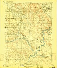
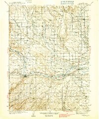
Other maps of this area

1885 · Ashley
USGS Topo · 1:250,000

1885 · Uinta
USGS Topo · 1:250,000
1917 · Vernal
USGS Topo · 1:125,000
1939 · Duchesne
USGS Topo · 1:125,000

1954 · Salt Lake City
USGS Topo · 1:250,000

1954 · Vernal
USGS Topo · 1:250,000

1958 · Vernal
USGS Topo · 1:250,000

1958 · Salt Lake City
USGS Topo · 1:250,000

1960 · Salt Lake City
USGS Topo · 1:250,000

1960 · Vernal
USGS Topo · 1:250,000