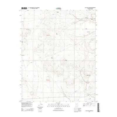
2014 Map of Na Ah Tee Canyon
USGS Topo · Published 2014About this map
Na Ah Tee and Indian Wells sit within a high desert landscape defined by the drainage systems of Na Ah Tee Canyon and Lokasakad Wash. This 2014 survey by the U.S. Geological Survey shows a network of Bureau of Indian Affairs routes, including Bia-15 and Bia-9813, which connect the isolated homesteads and grazing lands. The terrain is marked by distinctive volcanic and erosional features such as the Hopi Buttes, Gray Mesa, and Up Rock Point. Numerous water sources are documented across the arid expanse, providing essential points for local habitation, including Gopher Spring, Clay Spring, and the uniquely named Crazy Water Spring. The map details the transition from the high elevations of Flat Mesa down into the broad channels of Coyote Wash and Gleshbito Wash, reflecting the traditional land use and remote character of this portion of the Navajo Nation.
Find a feature on this map
29 named features on this map. Tap any name to fly to it.
Don’t see what you’re looking for? This feature index may not catch every label — zoom into the map to look around manually.
Map Details
Editions of this 2014 Na Ah Tee Canyon Map
This is the sole edition of this map. No revisions or reprints were ever made.
Other maps of this area

1883 · Tusayan
USGS Topo · 1:250,000

1886 · Tusayan
USGS Topo · 1:250,000

1947 · Flagstaff
USGS Topo · 1:250,000

1954 · Flagstaff
USGS Topo · 1:250,000

1958 · Flagstaff
USGS Topo · 1:250,000

1960 · Flagstaff
USGS Topo · 1:250,000

1962 · Flagstaff
USGS Topo · 1:250,000

1966 · White Cone
USGS Topo · 1:62,500

1966 · Egloffstein Butte
USGS Topo · 1:62,500
1967 · Dilkon
USGS Topo · 1:24,000