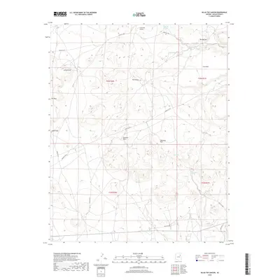
2018 Map of Na Ah Tee Canyon
USGS Topo · Published 2018About this map
Na Ah Tee sits within a landscape defined by an intricate network of desert water sources and dramatic landforms in this modern survey of the Navajo Nation. The topography is shaped by the Hopi Buttes and the prominence of Gray Mesa and Flat Mesa, while the drainage systems of Coyote Wash and Gleshbito Wash carve through the high desert floor. Local hydrology is remarkably detailed, noting specific desert springs and catchments such as Crazy Water Spring, Clay Spring, and the uniquely named Doh Halian. Transportation in this part of Navajo County is represented by a web of tribal routes, including Indian Rte 9065 and Indian Rte 9813, which provide the primary access to the isolated settlement at Na Ah Tee and the surrounding high country points like Up Rock Point.
Find a feature on this map
27 named features on this map. Tap any name to fly to it.
Don’t see what you’re looking for? This feature index may not catch every label — zoom into the map to look around manually.
Map Details
Editions of this 2018 Na Ah Tee Canyon Map
This is the sole edition of this map. No revisions or reprints were ever made.
Other maps of this area

1883 · Tusayan
USGS Topo · 1:250,000

1886 · Tusayan
USGS Topo · 1:250,000

1947 · Flagstaff
USGS Topo · 1:250,000

1954 · Flagstaff
USGS Topo · 1:250,000

1958 · Flagstaff
USGS Topo · 1:250,000

1960 · Flagstaff
USGS Topo · 1:250,000

1962 · Flagstaff
USGS Topo · 1:250,000

1966 · White Cone
USGS Topo · 1:62,500

1966 · Egloffstein Butte
USGS Topo · 1:62,500
1967 · Dilkon
USGS Topo · 1:24,000