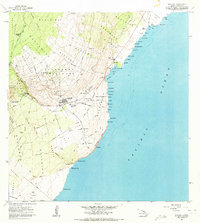
1962 Map of Naalehu
USGS Topo · Published 1973About this map
Waiohinu and Naalehu serve as the primary population centers on this coastal Hawaiian landscape, where the agricultural legacy of the islands is clearly visible. The presence of the Sugar Mill near Honuapo and the extensive Old Railroad Grade snaking through the Hokukano and Hiionaa land divisions point to the era's sugar industry infrastructure. Inland, the map documents the organized distribution of land through the Kaunamano Homesteads and Kiolakaa-Keaa Homesteads, which border the dense Kau Forest Reserve.
Find a feature on this map
84 named features on this map. Tap any name to fly to it.
Don’t see what you’re looking for? This feature index may not catch every label — zoom into the map to look around manually.
Map Details
Editions of this 1962 Naalehu Map
2 editions found
Other maps of this area

1923 · Pahala
USGS Topo · 1:62,500

1924 · Kalae
USGS Topo · 1:62,500

1924 · Honuapo
USGS Topo · 1:62,500

1954 · Hawaii South
USGS Topo · 1:250,000

1959 · Hawaii South
USGS Topo · 1:250,000

1961 · Hawaii South
USGS Topo · 1:250,000

1962 · Hawaii South
USGS Topo · 1:250,000

1962 · Kahuku Ranch
USGS Topo · 1:24,000
1962 · Ka Lae
USGS Topo · 1:24,000
1962 · Naalehu
USGS Topo · 1:24,000