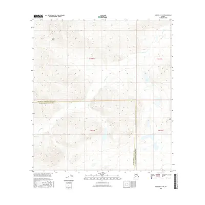
2016 Map of Nabesna C-3 NW
USGS Topo · Published 2016About this map
The Alaska Range defines the high-altitude character of this region within the Southeast Fairbanks Census Area, where steep topographic contours give way to the glacial drainage systems of the eastern interior. The Cheslina River winds through the central valley, serving as a primary hydrological feature as it flows toward the Tanana River basin. High points like Hill Point overlook a landscape largely devoid of human infrastructure, where the terrain is dominated by natural water bodies such as Fern Lake. This map captures the administrative divide between the Southeast Fairbanks and Valdez-Cordova census areas, illustrating how modern political boundaries are superimposed across the formidable natural obstacles of the Alaskan wilderness.
Find a feature on this map
10 named features on this map. Tap any name to fly to it.
Don’t see what you’re looking for? This feature index may not catch every label — zoom into the map to look around manually.
Map Details
Editions of this 2016 Nabesna C-3 NW Map
This is the sole edition of this map. No revisions or reprints were ever made.
Other maps of this area

1950 · Nabesna
USGS Topo · 1:250,000

1951 · Nabesna
USGS Topo · 1:250,000

1954 · Nabesna D-3
USGS Topo · 1:63,360

1954 · Nabesna C-3
USGS Topo · 1:63,360

1954 · Nabesna D-4
USGS Topo · 1:63,360

1955 · Nabesna D-3
USGS Topo · 1:63,360

1955 · Nabesna C-3
USGS Topo · 1:63,360
1960 · Nabesna D-4
USGS Topo · 1:63,360

1960 · Nabesna
USGS Topo · 1:250,000

1960 · Nabesna C-4
USGS Topo · 1:63,360